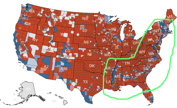
Here is a preliminary image from The Guardian showing the individual counties during the 2016 election in the United States:
There appears to be a line of counties in blue, curving from Maine in the north-east to Mississippi in the south. Those counties would have voted for the Democratic party, but they are massively surrounded by Republican counties. Is there something in common between them?
