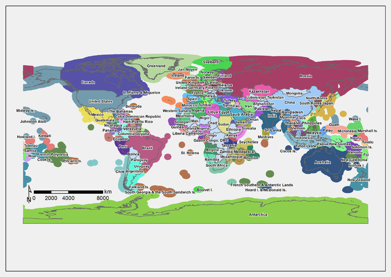
Is there a world map that depicts the borders including territorial waters?
2 Answers
There is a a layer in Google maps, note that link is somewhat dated, also there is an interactive web map at MarineRegions.org.
This image from CoastalWiki.org is produced using data from MarineRegions.org.
MarineRegions.org offer this and other datasets as GIS data (shp, kml), interactive maps, and static images (though none as pretty as the image below).
