To add a bit of detail to the other answer, apparently the plan (for now) is to encircle Khan Younis; CNN:
“Sixty days after the war began, our forces are now encircling the Khan Yunis area in the southern Gaza Strip,” Lt. Gen. Herzi Halevi said on Tuesday. “Simultaneously, we continue to secure our accomplishments in the northern Gaza Strip.”
Earlier Tuesday, the IDF said that its forces were operating “in the heart” of Khan Younis, the territory’s second-largest city.
In the north: Israeli troops have also "completed the encirclement" of the Jabalya refugee camp in northern Gaza, Israel's military said Tuesday, as it seeks to complete its offensive operations against Hamas militants in the north of the enclave.
Halevi said that the IDF was now entering the “third phase of the ground operations,” though he did not specify what that meant. “We have secured many Hamas strongholds in the northern Gaza Strip, and now we are operating against its strongholds in the south,” he said.
The earlier report carried by Fox News and others referred to Dec 5 as the heaviest day of fighting thus far:
An Israel Defense Forces commander said Tuesday that Israel’s military is currently “in the most intense day since the beginning of the ground operation -- in terms of terrorists killed, the number of firefights, and the use of firepower from the land and air.”
Maj. Gen. Yaron Finkelman, who leads the Southern Command, said in a statement that “We are in the heart of Jabalya, in the heart of Shuja'iyya, and now also in the heart of Khan Younis.”
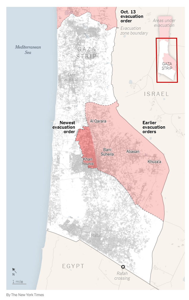
FWTW, the NYT published this map of evacuation orders/advice yesterday (Dec 4).

Israel expanded evacuation orders in the southern Gaza Strip on Sunday to parts of central and eastern Khan Younis, Gaza’s second-largest city, where hundreds of thousands fled in the first stage of the war. The orders come ahead of an expected ground invasion in the south.
The expanded orders follow earlier demands to evacuate the large area east of Khan Younis that borders Israel and encompasses the agricultural villages of Al Qarara, Bani Suheila, Abasan and Khuza’a.
Note that this is not a map of military advances. ISW which is the usual source of those has yet to publish one for the southern area/offensive as I'm writing this.
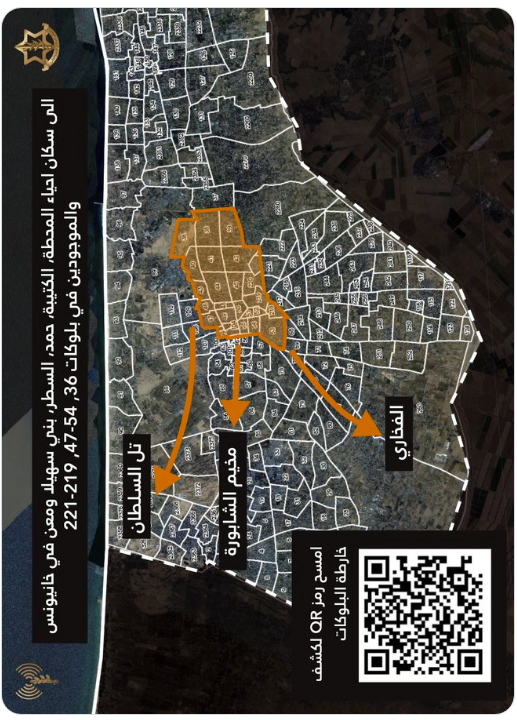
Also, I'm not sure if the earlier orders that the NYT alludes to stand or not. The IDF has published just this in Arabic recently on X (I've rotated so it would have the same orientation):

In lieu of a map of the offensive details, so far we have this textual description from AP (from two days ago):
The images, shot Sunday by Planet, show Israeli tanks and armored personnel carriers just under 6 kilometers (3.7 miles) north of the heart of Khan Younis, the major city of the southern part of the Gaza Strip. [...]
The Israeli deployment sits just to the west of Salah al-Din, a main north-south corridor within the Gaza Strip that many used to flee. An AP analysis found positions in four clusters, with a total of around 150 armored personnel carriers, tanks and other vehicles in the area.

